NEEDLES AREA, POTHOLE, CAVE SPRINGS, BIG SPRING, SQUAW CANYON, CHESLER
You will have the most amazing hiking day or days here in Canyonlands National Park! Everything from 1, 2, 3 mile hikes much longer hikes. The Needles, the many tall narrow standing spires of rock, challenge the forces of wind and rain and inspire any who see them.
There is great hiking for the smaller children as they can see caves and ruins. For the avid hiker there are long hikes with great views, and very strenuous hikes with ladders and scaling up and down very steep areas requiring more stamina.
The Needles area offers over 60 miles of interconnecting trails as challenging as they are rewarding. Many different itineraries are possible, but some of the more popular ones are listed below.
Short on time? Four short, self-guiding trails highlight various aspects of the area’s cultural and natural history. Trail guides are available in the visitor center and at the entrance to the park. These should guide you to the trail-heads. There is an entrance fee to get into the park.
Pothole Point
.6 mi/1 km, 45 minutes
Uneven surface Leads to pothole communities Great views of the Needles and Six Shooters
Slickrock Trail :2.4 mi/4 km, 2 hours
Uneven surface Several viewpoints and sometimes bighorn sheep Great views of the Needles (below)
Roadside Ruin: .3 mi/.5 km, 20 minutes
Easy trail Leads to an ancestral Puebloan granary. You can see the granary in the background of the picture.
Cave Spring: .6 mi/1 km, 45 minutes and two ladders
Leads to historic cowboy camp and Prehistoric pictographs. A great trail for children with lots of variety!
Don’t forget to stop at the Visitors Center for maps and other information. Restrooms are available. Bring lots of water, small backpacks, and good hiking shoes.
Most important . . . Don’t forget your camera!
For a list of longer hikes including some overnight hikes, see below.
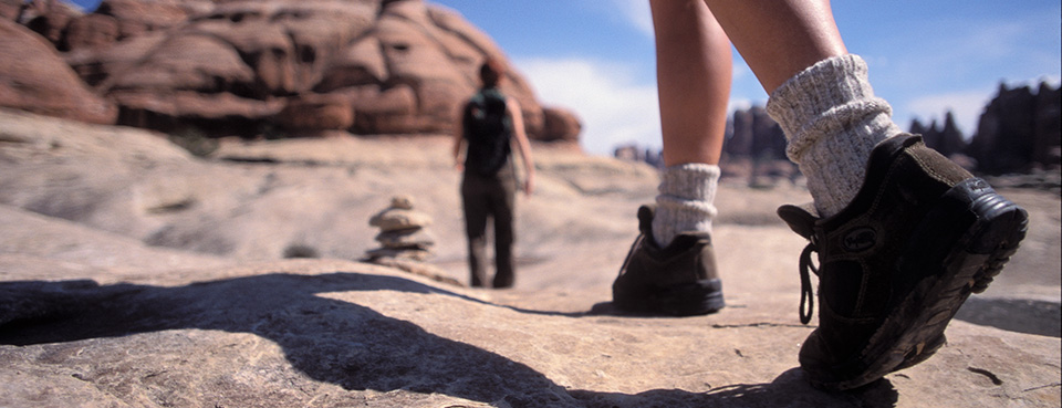
Some of the longer hikes include, Big Spring to Squaw, Squaw to Lost Canyon, Confluence, Peekaboo, Chesler Park, Druid Arch, Lower Red Lake, and Salt Creek Canyon. Conditions of these trails can be more primitive. Longer trails are especially rough and require negotiating steep passes with drop-offs, narrow spots, or ladders. Water in the backcountry is unreliable and scarce in some areas. Bring Plenty of it. Trails are marked with cairns (small rock piles).